Over the weekend, the “Mammoth Lakes 2” drill sample was delivered to CheMin for analysis. Mastcam change detection observations of “Walker Pass 2” and “Finch Lake” were initiated and are set to conclude on Sol 4225. Remote science activities on “Whitebark Pass,” “Quarry Peak,” “Broken Finger Peak,” and “Shout of Relief Pass” were successfully completed.
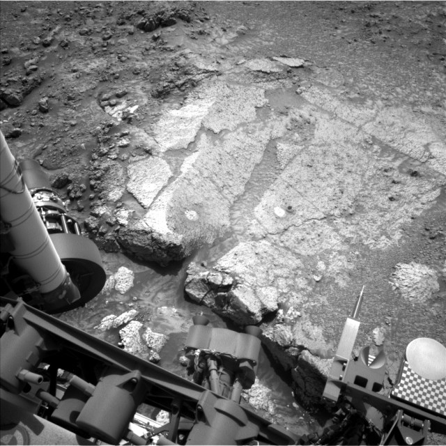
On Sol 4225, the main focus of remote science was on characterizing “Horsetail Falls” using ChemCam laser spectroscopy and Mastcam imaging. The Navcam image provided displays the rugged surface of “Horsetail Falls,” which appears as a streak of dark, rocky material near the top right edge of the light-colored “Whitebark Pass” slab. This area showcases a diverse texture of bedrock and is named after a notable 270 ft waterfall located at Agnew Lake, visible from the June Lake Loop road.
“Shout of Relief Pass” was named after the 11000 ft pass on the Sierra High Route trail, marking an entry point to easier terrain for the subsequent 25 miles of the trail. All designated targets in this region of Mount Sharp are named after the Bishop geological quadrangle in the High Sierra and Owens Valley of California. Additionally, ChemCam RMI will capture an 11×1 mosaic of the nearby channel floor to investigate intriguing color variations.
Atmospheric observations during this science block include a survey of dust devils. In the upcoming plan, SAM will finalize its initial analysis. Following the results from SAM and CheMin, the team will make a decision on whether to conduct further chemistry at the current location or proceed with the ascent up Mount Sharp.